Satellite Data May Help Fishermen Avoid Endangered Species
Study finds ocean temperature and color can help predict the presence of Atlantic sturgeon
 Matthew Breece
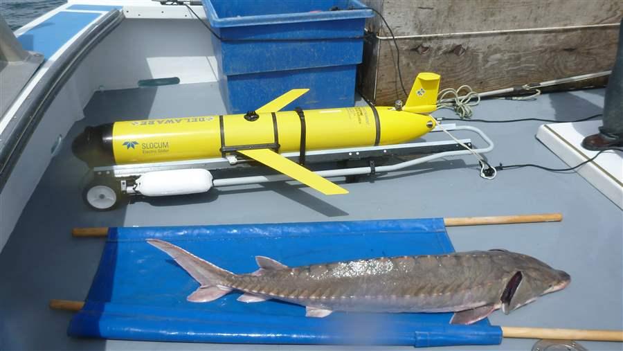
An Atlantic sturgeon next to the autonomous underwater vehicle used in this research.
Mid-Atlantic fishermen may soon have an online map to help them avoid catching endangered Atlantic sturgeon, thanks to new research led by Matt Oliver at the University of Delaware. The study is a promising step toward predicting sturgeon locations with satellite measurements of ocean color and temperature, which could help both fishermen and vulnerable fish species.
On land, it’s often easy to predict where a species will be based on features of the landscape. Oliver’s team set out to do something similar using “seascapes,” or zones of the ocean that can be readily identified.
The team started with Atlantic sturgeon, which is sometimes caught as bycatch by fishermen targeting monkfish and other species. If fishermen catch too many sturgeon, they could see cuts in their allowable catch of other fish. The study was published in the journal Methods in Ecology and Evolution and was supported by the Lenfest Ocean Program.
“This gets us closer to using habitat preferences as a guide to help fishermen be successful while reducing harm to non-target species,” said lead author Matthew Breece, a Ph.D. candidate in Oliver’s lab. “It’s surprisingly accurate, and we see a lot of options for making it even better.”
The research team studied the Delaware Bay and nearby coastal waters in Delaware, Maryland, and New Jersey. Using 10 years of satellite data, they looked for contiguous ocean areas that had similar color and temperature. Their analysis identified six seascapes that form strips roughly parallel to the coast and can be anywhere from one mile to 20 miles wide. Their shapes change and their locations shift, expand, and contract, sometimes by 10 miles or more in a single day.
The researchers combined these time-dependent seascape maps with locations of individual sturgeon. They determined locations using tags implanted in sturgeon that can be detected by a set of 94 stationary acoustic sensors arrayed along the coast. The team also deployed an unmanned underwater vehicle in 2013 to detect sturgeon. All told, they detected 280, some from as far away as South Carolina.
Based on the two maps, sturgeon appear to prefer a narrow corridor the researchers called Seascape E, which generally sits near the coast but sometimes expands into open waters. Half of the sturgeon detections were in that seascape, even though it covered only 35 percent of the available area. The scientists do not yet know why the sturgeon prefer this seascape.
“We still have work to do before this is ready for fishermen,” Oliver said. “But this gives us the scientific basis to build something really useful and to expand from sturgeon to other species.”
The team plans to expand to other species and to have a working website in one to two years.